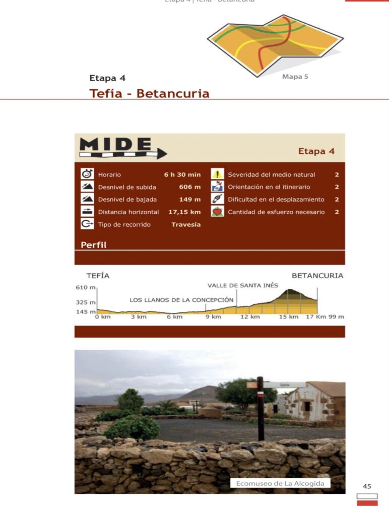
Tranche 4
Tefía - Betancuria
Stage 4 starts from the cultural centre of Tefía. We will travel approximately 1 km until we reach the Ecomuseum of La Alcogida, where we can appreciate the ancient customs and traditions of the island. From here, we head northwest until we come across a windmill that has six blades, unlike most of the windmills on Fuerteventura, which have four. Continue for 250 m in the same direction and turn left to cross the local road FV-221. We continue along a wide plain until we reach Bermeja mountain, which stands out in the landscape due to its reddish colouring which contrasts with the different shades of brown typical of the island. Its stone has traditionally been used for the construction of various buildings, as can be seen in some of the houses in Tefía. The path continues in a south-westerly direction until it reaches the village of Los Llanos de la Concepción, which we cross, following the signposts, until we reach the next village, Valle de Santa Inés. Access this village via an asphalt track that continues for approximately 1.5 km, which we leave to turn off to the left onto a dirt track. Once you have passed the last houses in Valle de Santa Inés, you will enter an important agricultural area and begin a continuous ascent until you reach a viewpoint. Here we can see the figures of two majos: Guise and Ayose, witnesses of how nature has been patiently eroding the relief of Fuerteventura, giving us today this landscape of rounded hills that reveal the oldest materials of the Canary Archipelago. We will then cross the local road FV-30 to begin a descent through wild tabaibas (Euphorbia regisjubae), acacias (Acacia) and some jorjaos (Asteriscus sericeus) that will lead us to what was the first Franciscan convent in the Canary Islands. We continue along Presidente Hormiga street for 300 m to turn right and, after a bend, we will reach a crossroads which we will cross to reach the end of this stage, the Plaza de la Iglesia de Santa María de Betancuria.


